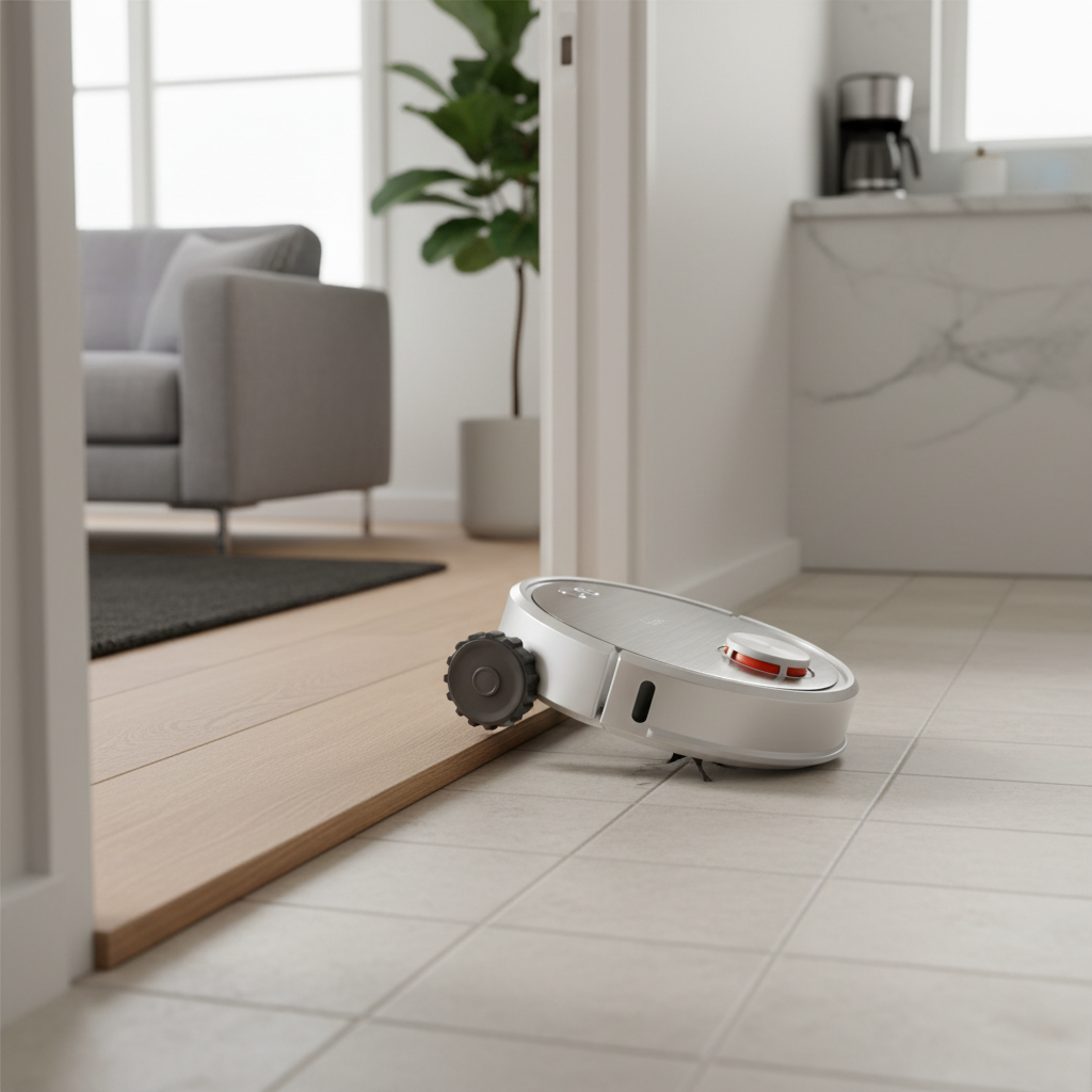
In an increasingly automated world, smart devices, from robot vacuums to self-driving cars, are transforming how we live and work. These sophisticated machines navigate our environments, perform tasks, and interact with their surroundings with astonishing autonomy. But how do they “see” the world around them? The answer lies primarily in two cutting-edge technologies: Lidar and camera-based navigation systems.
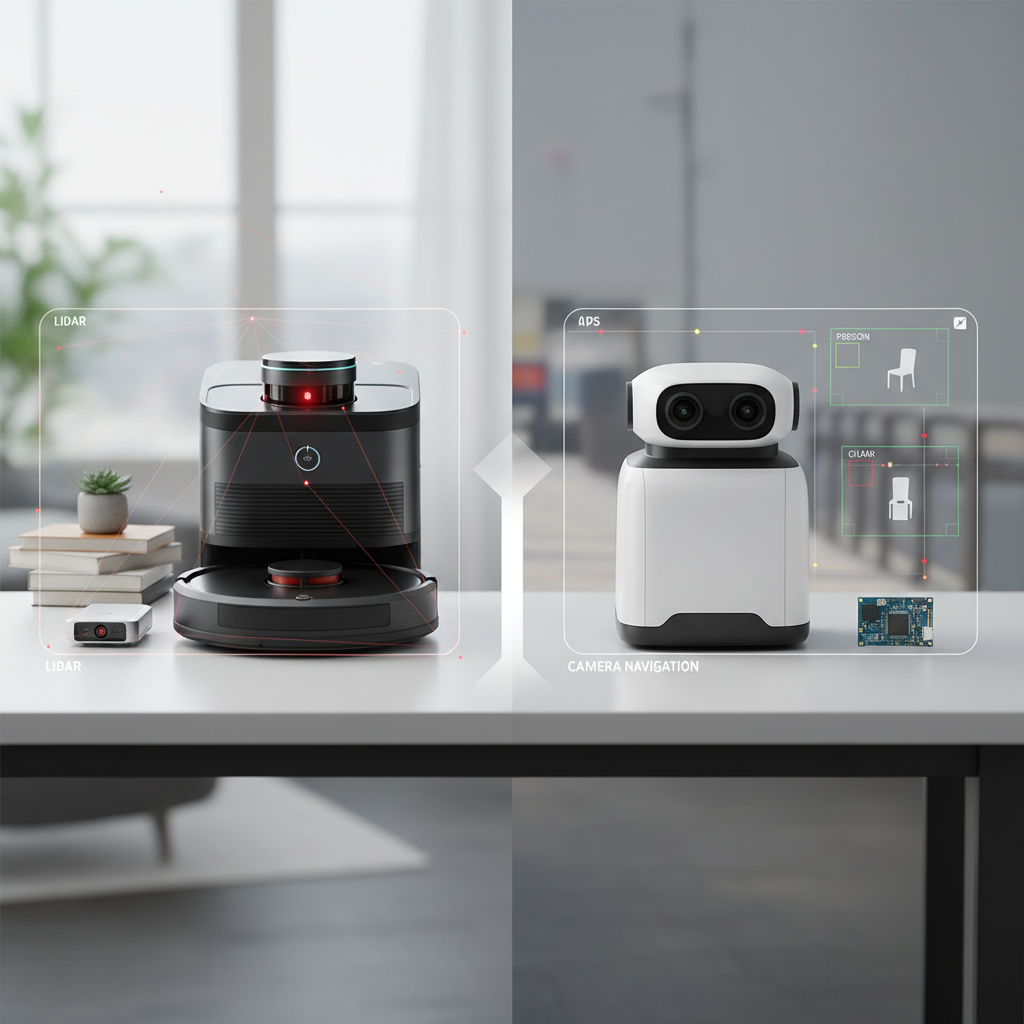
Choosing between Lidar and camera navigation isn’t about finding a single “best” solution, but rather understanding which technology, or combination thereof, is optimal for specific applications. This comprehensive guide will delve into the intricacies of both Lidar and camera navigation, dissecting their working principles, strengths, weaknesses, and ideal use cases. By the end, you’ll have a clearer picture of which technology might be the better fit for your needs and the future of intelligent automation.
Understanding Lidar Navigation
Lidar, an acronym for Light Detection and Ranging, is an active sensing technology that fundamentally transforms how machines perceive their environment. Imagine a laser scanner meticulously measuring every inch of a room or road; that’s the essence of Lidar.
At its core, a Lidar system emits numerous laser pulses in various directions. When these light pulses strike an object, they reflect back to the sensor. By precisely measuring the “Time of Flight” (the duration it takes for each pulse to travel to the object and return), the system calculates the exact distance to every point it illuminates. This process happens thousands, or even millions, of times per second, generating a highly detailed three-dimensional “point cloud” that accurately maps the surrounding environment. This 3D map provides robots with a precise understanding of shapes, sizes, and distances of objects, allowing for highly accurate localization and path planning.
Understanding Camera (vSLAM) Navigation
Conversely, camera-based navigation, often leveraging Visual Simultaneous Localization and Mapping (vSLAM), operates more akin to human vision. Instead of emitting light, vSLAM systems passively capture visual information from their surroundings using standard optical cameras.
These cameras continuously feed images or video streams to an onboard computer. Sophisticated algorithms then analyze these images, identifying key visual features such as corners, edges, textures, and specific landmarks. By tracking the movement of these features across consecutive frames, the vSLAM system simultaneously estimates its own position and orientation within the environment (localization) and builds a map of that environment. This method allows the robot to “see” and interpret its surroundings, recognize objects, and adapt to visual changes. While Lidar provides precise geometric data, vSLAM excels at extracting rich semantic information from the visual world, such as colors, labels on objects, and even the intent of moving subjects, like traffic lights or pedestrian signals.
Lidar vs. Camera: A Detailed Comparison
When evaluating Lidar and camera navigation systems, several critical factors come into play, each influencing their suitability for different autonomous applications.
Accuracy and Precision
|
Our Picks for the Best Robot vacuum cleaner in 2026
As an Amazon Associate I earn from qualifying purchases.
|
||
| Num | Product | Action |
|---|---|---|
| 1 | SHELIKI Robot Vacuum and Mop Combo, 3-in-1 Robotic Vacuums Cleaner with 70-Day Self-Emptying Base, LiDAR Navigation Smart Mapping & Strong 6000Pa Suction, for Pet Hair, Hard Floor, Carpet |

|
| 2 | roborock Qrevo Series Robot Vacuum and Mop, 8000Pa Suction, Upgraded from Qrevo S, Anti-Tangle Brushes, Smart Obstacle Avoidance, Auto Mop Washing, All-in-One Dock, 200RPM Spinning Mops, Black(QV 35A) |
|
| 3 | Shark Matrix Clean | Robot Vacuum Cleaner with Powerful Suction for Pet Hair, Rugs, Carpets & Hard Floors | Self-Empty Base | 60-Day Capacity | Voice Control | LiDAR Navigation | Cool Grey | AV2511AE |
|
| 4 | eufy Robot Vacuum 11S MAX, Super Thin, Powerful Suction, Quiet, Self-Charging Robotic Vacuum Cleaner, Cleans Hard Floors to Medium-Pile Carpets, Black |
|
| 5 | roborock Q7 M5+ Robot Vacuum and Mop, Upgraded from Q5 Max+, Up to 7-9 Weeks Self-Empty, 10000Pa Suction, Dual Anti-Tangle System for Pet Hair & Carpet, PreciSense LiDAR Navigation, App Control, Black |
|
| 6 | Robot Vacuum and Mop, Mapping Robotic Vacuums Cleaner with LiDAR Navigation Smart & Strong Suction, WiFi/App/Alexa/Voice Control, Obstacle Avoidance, for Home, Wood/Hard Floors, Pet Hair -Gray |
|
| 7 | Tikom Robot Vacuum and Mop, 6000Pa Robotic Vacuum Cleaner with Self-Emptying Base, 90 Days Capacity, LiDAR Navigation, Home Mapping, Ideal for Pet Hair, Hard Floors, Carpet (L8000 Plus) |
|
| 8 | ILIFE V2 Robot Vacuum Cleaner, Tangle-Free Suction, 120 Mins Runtime, Slim, Self-Charging Robotic Vacuum Cleaner, Ideal for Pet Hair and Hard Floors |
|
| 9 | Tikom Robot Vacuum and Mop Combo, 5000Pa Robotic Vacuum Cleaner, 150 Min Max, App & Remote Control, Ideal for Hard Floor, Carpet, Pet Hair, Self-Charge(G8000 Max) |
|
| 10 | Robot Vacuum and Mop Combo, 2 in 1 Robot Vacuum Cleaner with WiFi/App, Smart Robotic Vacuums with Strong Suction, Schedule, Self-Charging, Slim, Quiet, Ideal for Hard Floor, Pet Hair, Low Pile Carpet |
|
LiDAR’s exact measurements provide unparalleled precision in 3D mapping and distance measurement. By bouncing laser pulses off objects, Lidar systems can calculate exact distances with high fidelity, creating a consistent and detailed 3D map of the environment. This makes them exceptionally reliable for applications demanding millimeter-level accuracy.
Camera-based systems, on the other hand, rely on visual estimations. While they can identify objects and their relative positions, accurately measuring precise distances from 2D images is a complex computational challenge. Though advancements in AI and stereo cameras have improved depth perception, cameras generally offer less direct and consistent distance accuracy compared to Lidar.
Environmental Performance (Lighting & Weather)
LiDAR excels in varied lighting conditions, including complete darkness. As an active sensor, it generates its own light source (lasers), making it entirely independent of ambient light. This capability is crucial for robot vacuums cleaning under furniture or in dimly lit rooms, and for autonomous vehicles operating at night or in tunnels. Lidar is also largely unaffected by shadows, reflections, or glare, which can significantly hinder camera performance.
Camera navigation, however, is highly dependent on sufficient illumination. It struggles in low-light environments, darkness, or situations with harsh shadows and bright glare, where visual features become difficult to discern. While thermal cameras can mitigate some of these issues, standard optical cameras are limited by visibility. In adverse weather conditions like dense fog, heavy rain, or snow, cameras can also lose significant clarity, though it’s important to note that certain “white-out” conditions can also challenge Lidar’s laser penetration.
Obstacle Detection and Recognition
LiDAR’s strength lies in accurate obstacle detection and avoidance based on precise geometry. It can quickly map the size, shape, and exact position of obstacles, from large furniture to small wires, enabling robots to navigate complex layouts and avoid collisions efficiently. Its 3D data provides a robust understanding of physical impediments.
Cameras, while capable of visual object recognition, are less precise at determining an object’s exact distance and depth. This can make avoiding smaller or unusual obstacles more challenging if not supplemented with advanced AI. However, cameras shine in semantic understanding—identifying what an object is (e.g., a pet, a toy, a traffic sign, a pedestrian’s intent) based on color, texture, and learned patterns. This semantic richness is something Lidar cannot inherently provide.
Cost and Scalability
Historically, LiDAR systems have been significantly more expensive due to their intricate laser components and precision engineering. This higher cost has often limited their adoption to premium devices and research projects. However, the cost of Lidar technology is rapidly decreasing, making it more accessible for broader commercial applications.
Camera-based systems boast a distinct advantage in affordability and scalability. Utilizing commodity optical hardware, cameras are much cheaper to produce and integrate, making them a budget-friendly option for mass-market products. This cost-effectiveness allows for the deployment of multiple cameras for wider coverage or redundancy without drastically increasing the overall price.
Privacy Implications
LiDAR offers a higher degree of privacy. Since it generates anonymous 3D point clouds that represent shapes and distances rather than identifiable visual data, it does not capture faces, specific clothing details, or other personal information. This makes Lidar a preferred choice for applications in public spaces or private homes where data protection is a primary concern.
Camera navigation, by its very nature, captures identifiable visual data. Images and video feeds can potentially record sensitive areas of a home or even individuals, raising significant privacy risks if data is not handled with the utmost security. While many systems employ measures like blurring or onboard processing to mitigate these risks, the inherent capability to capture personal visuals remains a point of concern for some users.
Computational Demands
Both Lidar and camera systems demand considerable computational resources, but in different ways. Processing the vast amounts of 3D point cloud data generated by Lidar for real-time mapping and object tracking requires powerful processors. The density and precision of Lidar data mean complex algorithms are needed to efficiently interpret and utilize this information.
Camera-based navigation also has significant computational demands, particularly with advanced vSLAM and deep learning algorithms. Transforming 2D visual information into a reliable 3D understanding, identifying objects, and making real-time navigation decisions based on image analysis requires powerful AI models and substantial processing power.
The Synergistic Power of Sensor Fusion
While Lidar and camera systems each possess distinct advantages and disadvantages, the cutting edge of autonomous technology often lies in their combination. This approach, known as sensor fusion, integrates data from multiple sensor modalities to create a more comprehensive, robust, and reliable understanding of the environment.
In high-end robot vacuums, for instance, Lidar might provide the foundational 3D map for efficient room layout and path planning, ensuring thorough coverage even in the dark. Simultaneously, a camera can be used to identify specific small objects on the floor, like pet waste or charging cables, allowing the robot to avoid them with greater intelligence than Lidar alone could achieve. This synergy results in superior obstacle avoidance and a more intelligent cleaning experience.
Similarly, in autonomous vehicles, Lidar delivers precise distance measurements and robust 3D structural data, crucial for accurately detecting obstacles and mapping the road ahead, especially at high speeds or in low light. Cameras, meanwhile, provide vital semantic information—reading traffic signs, identifying traffic light colors, distinguishing pedestrians from inanimate objects, and understanding complex human behaviors. By fusing these diverse data streams, autonomous systems can overcome the individual limitations of each sensor, achieving higher levels of safety and autonomy.
“The true magic in autonomous systems isn’t just in one sensor, but in how intelligently they work together. Sensor fusion allows robots to build a richer, more dependable perception of their world, far beyond what any single technology could achieve.” – Dr. Ava Sharma, Robotics and AI Ethicist
Choosing Your Navigation System: Key Considerations
Deciding between Lidar and camera navigation, or a hybrid system, depends largely on your specific needs, environment, and budget.
- Environment: For complex layouts, large spaces, or homes with frequent low-light conditions (e.g., cleaning at night, under furniture), Lidar offers superior mapping and navigation reliability. If your home is consistently well-lit and less cluttered, a camera-based system might suffice.
- Budget: Camera-only systems are generally more budget-friendly. If you’re seeking top-tier performance, precision, and robust obstacle avoidance, particularly in challenging conditions, investing in a Lidar or hybrid system is often worthwhile.
- Specific Needs: If you have pets that might leave small, irregular messes, a system with a camera (especially with AI object recognition) can be invaluable for identifying and avoiding these. If privacy is a major concern, LiDAR offers an advantage by not capturing identifiable visual data.
- Future-Proofing: Hybrid systems that combine both Lidar and cameras represent the most advanced and future-proof navigation solutions, offering the best balance of precision, intelligence, and adaptability.
Comparison Table: Lidar vs. Camera Navigation
| Feature | LiDAR Navigation | Camera (vSLAM) Navigation |
|---|---|---|
| Working Principle | Active: Emits laser pulses (Time of Flight) | Passive: Captures visual images, analyzes features |
| Data Output | Highly accurate 3D point clouds/maps | 2D images, constructs 2D/3D maps based on visual features |
| Accuracy (Mapping) | High: Precise distance, consistent mapping in complex spaces | Moderate: Relies on visual estimation, less precise depth |
| Low Light/Darkness | Excellent: Works independently of ambient light | Poor: Requires sufficient ambient light, struggles in dark |
| Obstacle Avoidance | High: Detects objects with precise geometry, robust avoidance | Moderate: Recognizes objects visually, less direct depth perception |
| Semantic Understanding | Low: Primarily geometric data (shape, size, distance) | High: Interprets color, texture, signs, object classification |
| Environmental Resilience | Good: Less affected by glare/shadows, light fog | Poor: Struggles with fog, glare, heavy shadows, dust |
| Cost | Higher (though rapidly decreasing) | Lower (commodity hardware, widely available) |
| Privacy | High: Generates anonymous spatial data | Lower: Captures identifiable visual data, potential concerns |
| Computational Demands | Significant for processing dense 3D point clouds | Significant for advanced image processing and AI |
| Common Application | High-end robot vacuums, advanced autonomous vehicles, industrial mapping | Budget robot vacuums, basic ADAS, certain smart home devices |
Conclusion
The debate of Lidar vs. camera navigation ultimately highlights two distinct yet powerful approaches to spatial intelligence. Lidar excels in providing precise 3D geometric mapping, robust obstacle avoidance, and reliable performance across varying light conditions, making it ideal for accurate and efficient navigation in complex environments. Camera-based systems, conversely, offer a cost-effective solution with rich semantic understanding, allowing devices to interpret visual cues like colors and signs, and adapt to visual changes.
However, the future of autonomous devices increasingly points towards sensor fusion, where the strengths of both Lidar and cameras are combined. By leveraging Lidar for foundational spatial understanding and cameras for detailed object recognition and semantic context, these hybrid systems offer an unparalleled level of perception and reliability. As technology continues to evolve and costs decrease, integrated solutions will become the standard, empowering devices to navigate our world with greater intelligence and safety.
Which navigation system do you prioritize for your next smart device—raw precision, rich visual intelligence, or the best of both worlds?
Frequently Asked Questions
What are the main advantages of LiDAR over cameras for navigation?
LiDAR offers superior precision in 3D mapping and distance measurement, operates effectively in complete darkness or low-light conditions, and generates anonymous spatial data, addressing privacy concerns. Its active sensing method makes it highly reliable for robust obstacle avoidance.
Can a robot vacuum use both LiDAR and camera?
Yes, many advanced robot vacuums now combine both LiDAR and camera technologies. This sensor fusion allows them to benefit from LiDAR’s precise mapping and dark-room navigation, while also using cameras for enhanced object recognition and semantic understanding, leading to a more comprehensive and intelligent cleaning experience.
Is camera navigation good for homes with pets?
Camera navigation can be good for homes with pets, especially with advanced AI that helps identify and avoid specific objects like pet toys or messes. However, camera systems rely on good lighting, so their performance may drop in dimly lit areas where pets might also be active. LiDAR is often considered more reliable for navigating around pet-related obstacles in various lighting.
How do lighting conditions affect camera-based robot vacuums?
Camera-based robot vacuums are heavily dependent on ambient light. In low-light conditions, darkness, or areas with strong glare or shadows, their ability to “see,” map, and avoid obstacles can be significantly compromised, leading to less efficient cleaning or missed spots.
Which is more future-proof, LiDAR or camera navigation?
The most future-proof approach is widely considered to be sensor fusion, combining both LiDAR and camera navigation. This hybrid strategy leverages the complementary strengths of each technology, providing a more robust, versatile, and intelligent perception system that can adapt to a wider range of scenarios and environmental challenges as autonomous technology continues to advance.